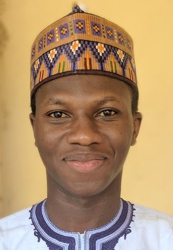
Mr Dogara Iyal Bashir
Graduate Assistant
- Department
- Department of Geography
- Specialization
- Remote Sensing and Geographic Information Systems (GIS) and the application of advanced geospatial technologies to environmental management and sustainable development.
- bidogara@nda.edu.ng
Academic Profiles
Biography
Dogara Iyal Bashir is a Graduate Assistant in the Department of Geography at the Nigerian Defence Academy, where he is actively engaged in teaching, research, and academic support in the field of geospatial sciences. He is currently pursuing a Master of Science (M.Sc.) degree in Remote Sensing and Geographic Information Systems (GIS) in the Department of Geography, Nigerian Defence Academy, Kaduna. He holds a Bachelor of Science (B.Sc.) degree in Geography from Usmanu Danfodiyo University, Sokoto. His academic training has provided a strong foundation in spatial analysis, environmental management, cartography, and geospatial data applications. His postgraduate studies further strengthen his expertise in remote sensing, satellite image analysis, GIS, and spatial modelling for addressing contemporary environmental and developmental challenges. Mr Bashir's research interests include remote sensing, geographic information systems (GIS), environmental monitoring, land-use and land-cover change analysis, disaster risk management, natural resource management, and sustainable development. He is particularly interested in leveraging geospatial technologies to generate evidence-based solutions for policy formulation, environmental planning, and informed decision-making. He actively contributes to undergraduate instruction, departmental research initiatives, and the promotion of innovative geospatial applications that support environmental sustainability, resource management, and national development.
Qualifications
Bachelor of Science Degree in Geography
Usmanu Danfodiyo University, Sokoto.
2017 – 2021
Specialization
Remote Sensing and Geographic Information Systems (GIS) and the application of advanced geospatial technologies to environmental management and sustainable development.
Research Interests
Mr Bashir's research interests include remote sensing, geographic information systems (GIS), environmental monitoring, land-use and land-cover change analysis, disaster risk management, natural resource management, and sustainable development.